
![[District 7 Briefing]](images/district7.png)
![[District 8 Briefing]](images/district8.gif)
Tropical Update
Atlantic Tropical Cyclones/Disturbances
Atlantic Tropical Weather Outlook


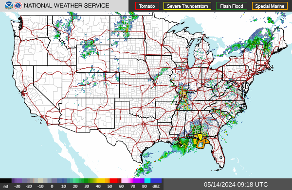
NWS Watch, Warning, and Advisory Map
Hover over map to enlarge. Click on map for full map and product legend.

Offshore Waters Forecast Text Products
Marine Graphical Forecast Map
Current Marine Conditions


Gulf Coast Surface Analysis
Southeast U.S. Surface Analysis


Atlantic Wave Height Analysis
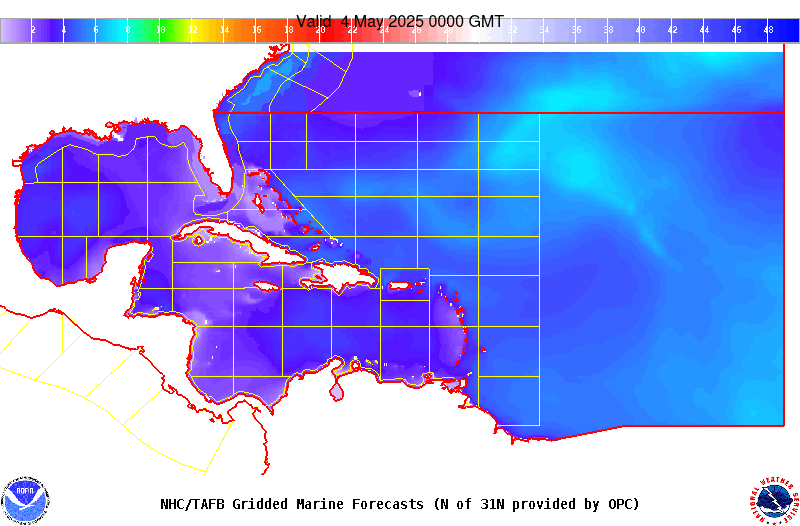
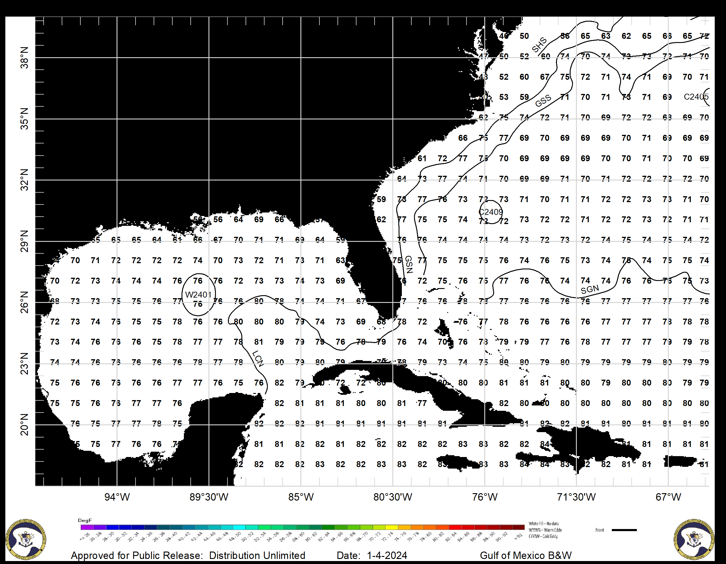
Atlantic SST & Gulf Stream Analysis

Gulf of America & Atlantic Marine Forecasts
24-hr Wind & Wave Forecast
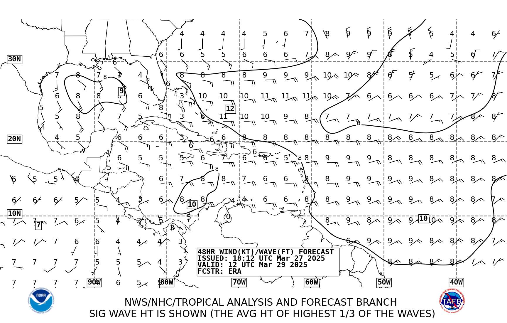
48-hr Wind & Wave Forecast
72-hr Wind & Wave Forecast


24-hr Wave Period & Direction Forecast
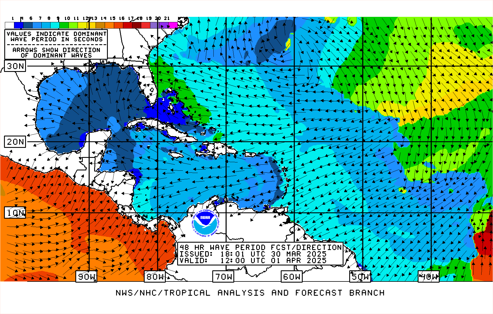
48-hr Wave Period & Direction Forecast
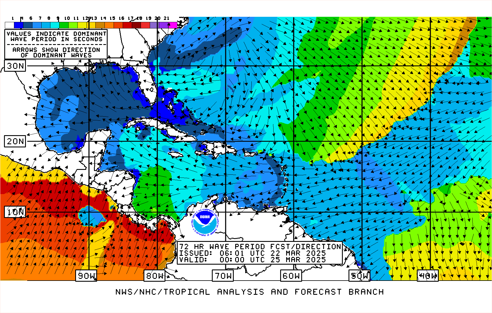
72-hr Wave Period & Direction Forecast

24-hr Surface Features Forecast
48-hr Surface Features Forecast
72-hr Surface Features Forecast


Nearshore Wave Prediction System (NWPS)
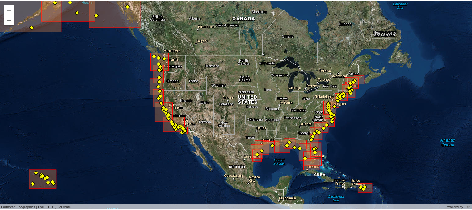
Nearshore Wave Prediction System (NWPS) provides on-demand, high-resolution nearshore wave model guidance that is triggered by forecast wind grids prepared and submitted by the individual NWS weather forecast offices.
Click a map below to view raw NWPS model output. For the official local marine forecasts, consult the latest products issued by NWS New Orleans/Baton Rouge or NWS Miami.
Click a map below to view raw NWPS model output. For the official local marine forecasts, consult the latest products issued by NWS New Orleans/Baton Rouge or NWS Miami.
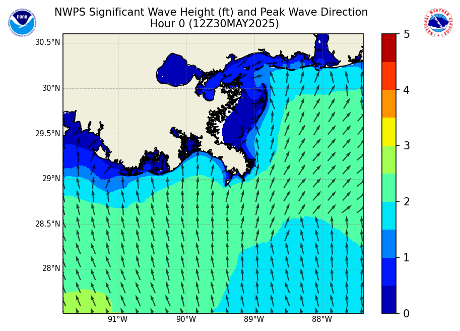
North-Central Gulf Coastal Waters
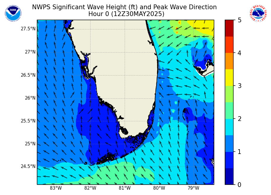
South Florida Coastal Waters
CONUS Weather Forecasts
Day 1 Weather Forecast
Day 2 Weather Forecast
Day 3 Weather Forecast


Day 1 Max Temperature Forecast
Day 2 Max Temperature Forecast
Day 3 Max Temperature Forecast


Day 1 Min Temperature Forecast
Day 2 Min Temperature Forecast
Day 3 Min Temperature Forecast


Day 1 Severe Thunderstorm Risk
Day 2 Severe Thunderstorm Risk
Day 3 Severe Thunderstorm Risk


Day 1 Excessive Rainfall Forecast
Day 2 Excessive Rainfall Forecast
Day 3 Excessive Rainfall Forecast


Aviation Forecasts
SIGMET Icing
SIGMET Thunderstorms
SIGMET Turbulence

AIRMET Sierra
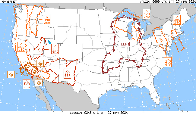
AIRMET Tango
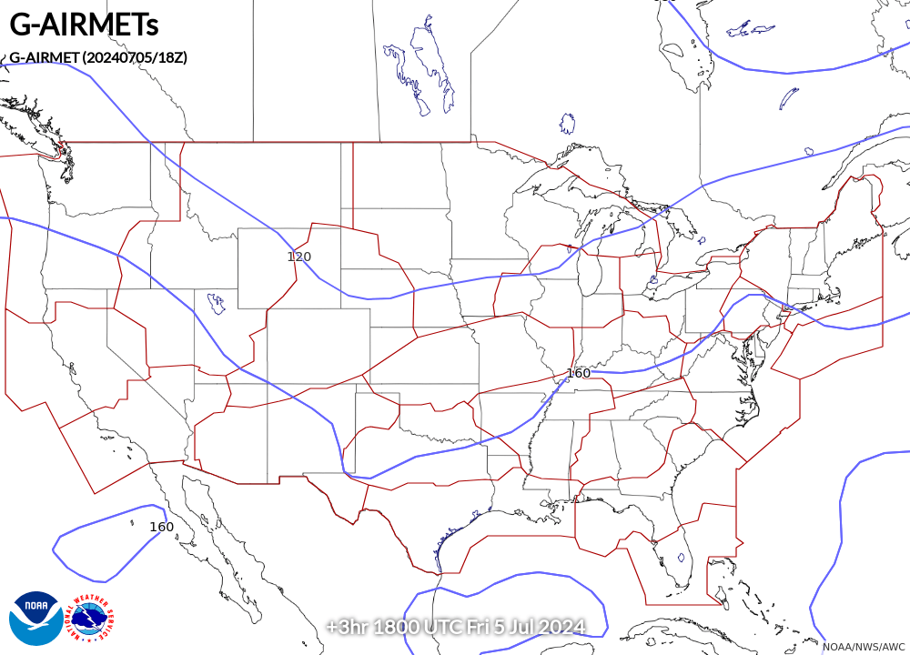
AIRMET Zulu

River Forecasts
River Observations & Forecasts
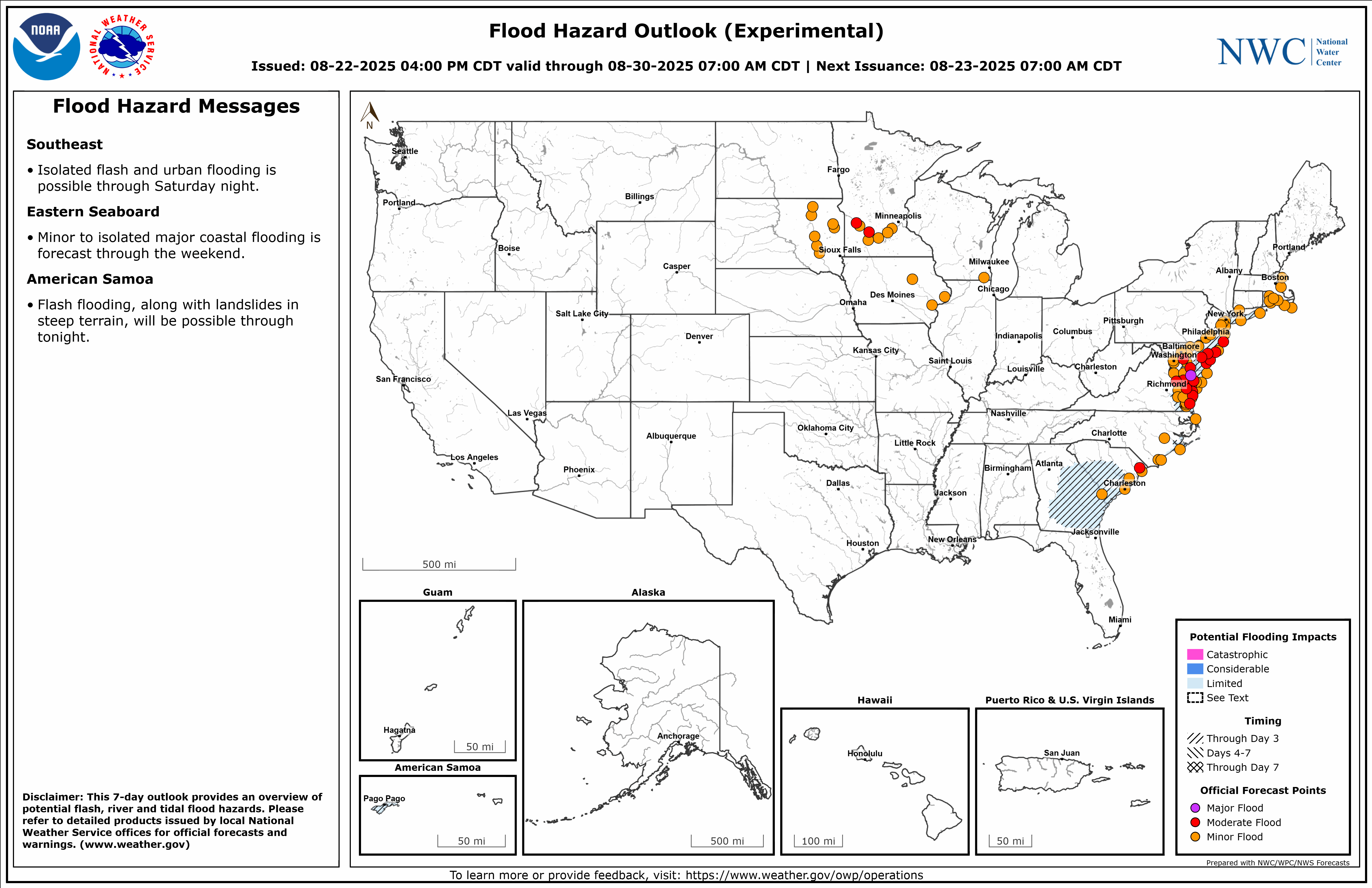
National Flood Hazard Outlook
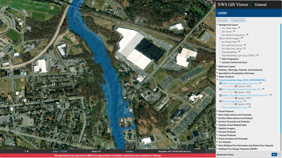
Flood Inundation Mapping

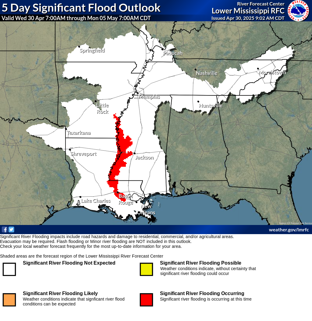
Lower Mississippi River Flood Outlook
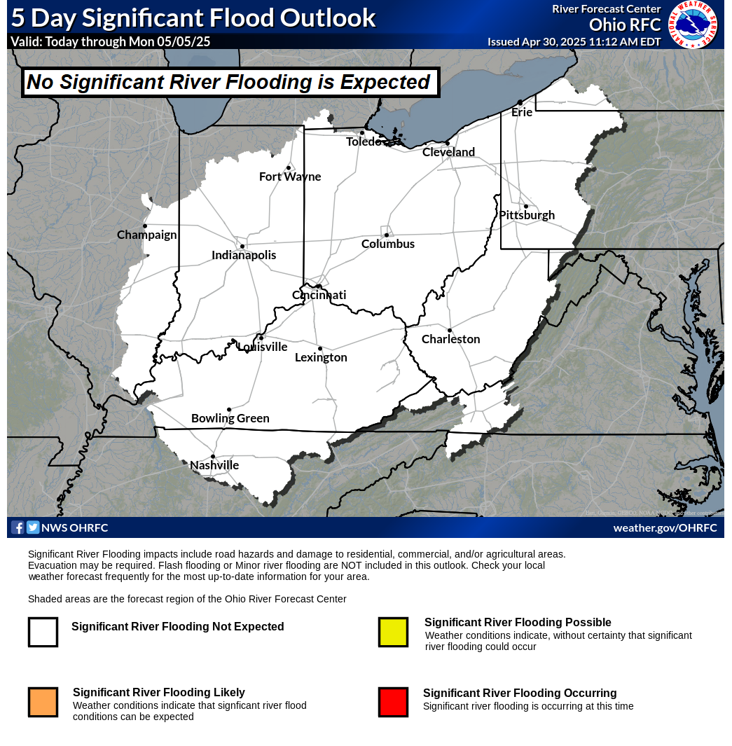
Ohio River Flood Outlook
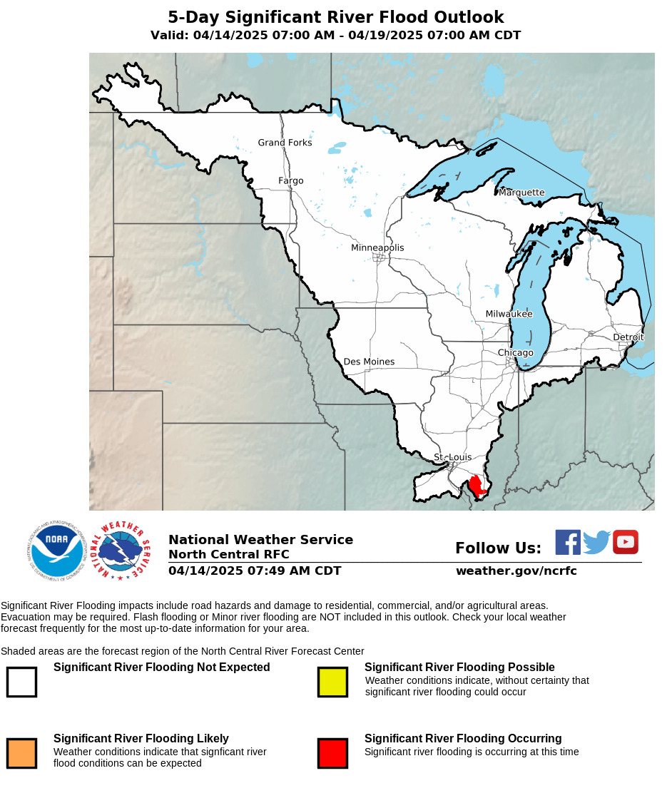
North Central River Flood Outlook
Archived Weather Products
Surface Analysis Archive (1998 - )
NOAA Buoy Archive
Radar Data Archive (2010 - )


Other Links
NOAA Tides and Currents
NOAA BuoyCAMs
NOAA Buoy Observations


This prototype webpage is under development: Not to be used for operational decision making purposes.
Please contact Brad Reinhart for questions, concerns, or feedback. Thanks!