ZCZC MIATWOAT ALL
TTAA00 KNHC DDHHMM
Tropical Weather Outlook
NWS National Hurricane Center Miami FL
200 AM EDT Tue Jul 2 2024
For the North Atlantic...Caribbean Sea and the Gulf of Mexico:
Active Systems:
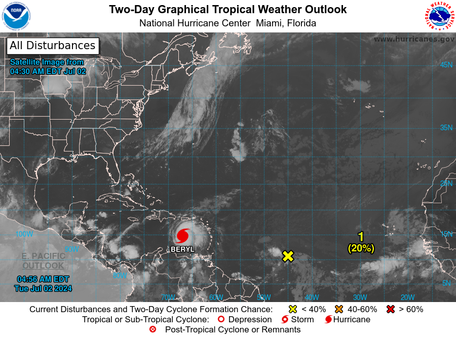
The National Hurricane Center is issuing advisories on Hurricane
Beryl, located over the southeastern Caribbean Sea.
1. Central Tropical Atlantic (AL96):
Disorganized showers and thunderstorms remain limited in
association with an area of low pressure located about 1000 miles
east-southeast of the Windward Islands. Environmental conditions
are only marginally conducive for additional development of this
system while it moves generally westward at 15 to 20 mph across
the central and western tropical Atlantic. Interests in the Lesser
Antilles should still monitor the progress of this system, with
heavy rainfall possible midweek.
* Formation chance through 48 hours...low...20 percent.
* Formation chance through 7 days...low...30 percent.
Forecaster Blake