


NHC Graphical Outlook Archive
|
« Earliest Available ‹ Earlier Later › Latest Available » |
GIS Shapefiles |
| Central Pacific | Eastern Pacific | Atlantic |
|
Tropical Weather Outlook Text
ZCZC HFOTWOCP ALL
TTAA00 PHFO DDHHMM
Tropical Weather Outlook
NWS Central Pacific Hurricane Center Honolulu HI
800 AM HST Thu Aug 15 2024
For the central North Pacific...between 140W and 180W:
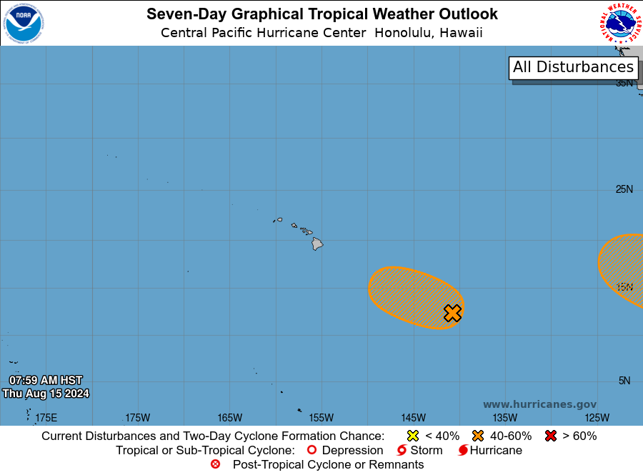
1. Well Southeast of the Hawaiian Islands:
Disorganized showers and thunderstorms located about a thousand
miles east-southeast of the Hawaiian Islands are associated with a
trough of low pressure, which has moved into the Central Pacific
Hurricane Center\'s area of responsibility. Environmental
conditions appear conducive for gradual development of this system,
and a tropical depression could form this weekend or early next
week while moving west-northwestward at about 10 mph.
* Formation chance through 48 hours...low...30 percent.
* Formation chance through 7 days...medium...60 percent.
Elsewhere, no tropical cyclones are expected during the next 7 days.
Forecaster Kino
List of Atlantic Outlooks (May 2023 - Present)
List of East Pacific Outlooks (May 2023 - Present)
List of Central Pacific Outlooks (May 2023 - Present)
List of Atlantic Outlooks (July 2014 - April 2023)
List of East Pacific Outlooks (July 2014 - April 2023)
List of Central Pacific Outlooks (June 2019 - April 2023)
List of Atlantic Outlooks (June 2009 - June 2014)
List of East Pacific Outlooks (June 2009 - June 2014)