ZCZC HFOTWOCP ALL
TTAA00 PHFO DDHHMM
Tropical Weather Outlook...Corrected
NWS Central Pacific Hurricane Center Honolulu HI
520 AM HST Sun Sep 22 2024
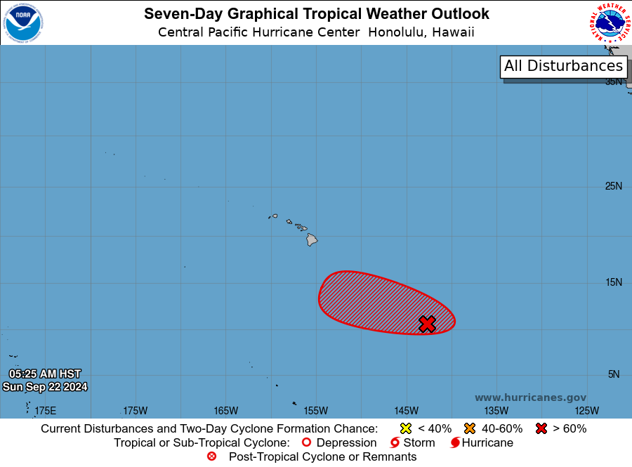
For the central North Pacific...between 140W and 180W:
1. Approximately 1050 miles southeast of Hilo, Hawaii:
An area of low pressure located far southeast of Hawaii continues
to produce disorganized showers and thunderstorms, while conditions
aloft continue to produce good outflow. Environmental conditions
appear conducive for some development over the next few days, and a
tropical depression could form as it moves westward at 5 to 10 mph.
By midweek, conditions will become gradually less conducive for
development.
* Formation chance through 48 hours...medium...near 50 percent.
* Formation chance through 7 days...high...70 percent.
Forecaster Bohlin