ZCZC HFOTWOCP ALL
TTAA00 PHFO DDHHMM
Tropical Weather Outlook
NWS Central Pacific Hurricane Center Honolulu HI
800 PM HST Mon Sep 23 2024
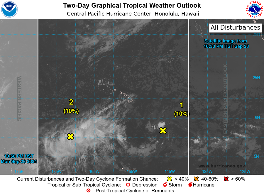
For the central North Pacific...between 140W and 180W:
1. Approximately 800 miles southeast of Hilo, Hawaii:
Showers and thunderstorms have diminished with a trough of low
pressure located far southeast of Hawaii. Environmental conditions
are becoming increasing unfavorable for further development of this
system as it moves west at 10 mph.
* Formation chance through 48 hours...low...10 percent.
* Formation chance through 7 days...low...10 percent.
2. Approximately 1100 miles southwest of Honolulu, Hawaii:
Numerous showers and enhanced thunderstorms are in association with
an area of broad low pressure located far southwest of the Hawaiian
Islands. As the low moves northwest the next couple of days,
environmental conditions may become marginally conducive
for the development of this system.
* Formation chance through 48 hours...low...10 percent.
* Formation chance through 7 days...low...10 percent.
Forecaster Blood