ZCZC HFOTWOCP ALL
TTAA00 PHFO DDHHMM
Tropical Weather Outlook
NWS Central Pacific Hurricane Center Honolulu HI
800 PM HST Tue Oct 29 2024
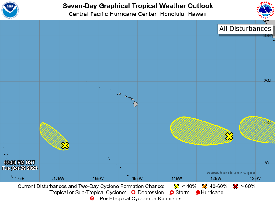
For the central North Pacific...between 140W and 180W:
1. About 1600 miles east-southeast of Hilo, Hawaii (EP91):
A broad area of low pressure is producing disorganized shower
activity. Some development of this system is possible during the
next few days while the system moves generally westward at about 15
mph. This system is expected to cross into the Central Pacific
Basin by the end of the week.
* Formation chance through 48 hours...low...20 percent.
* Formation chance through 7 days...low...30 percent.
2. About 1300 miles southwest of Honolulu, Hawaii:
An area of low pressure is producing disorganized shower activity.
Environmental conditions appear to be favorable for some slow
development over the next day or so as the system moves
northwestward around 15 mph. The system is expected to cross into
the Western Pacific Basin Wednesday night.
* Formation chance through 48 hours...low...10 percent.
* Formation chance through 7 days...low...10 percent.
Elsewhere, no tropical cyclones are expected during the next 7
days.
Forecaster Gibbs