ZCZC MIATWOEP ALL
TTAA00 KNHC DDHHMM
Tropical Weather Outlook
NWS National Hurricane Center Miami FL
1100 PM PDT Wed Jul 3 2024
For the eastern North Pacific...east of 140 degrees west longitude:
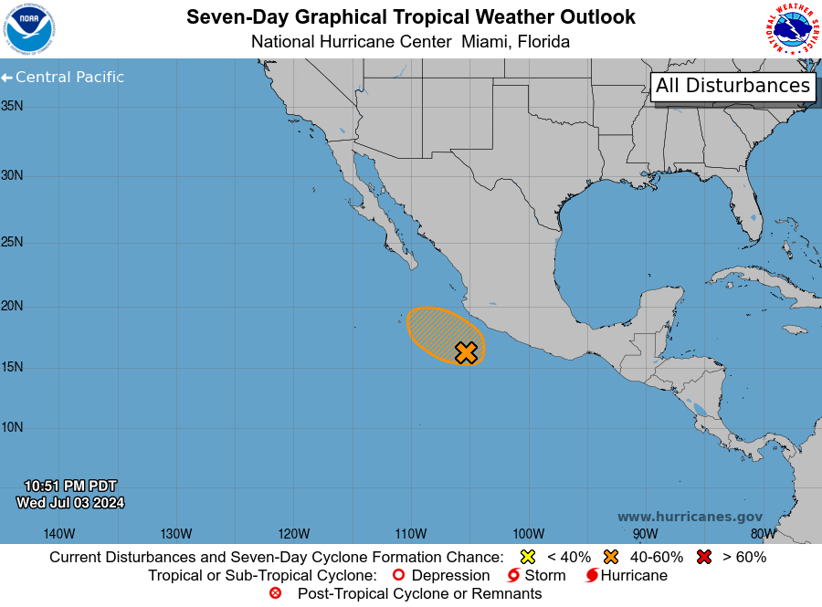
1. Offshore of Southern Mexico (EP91):
A concentrated area of showers and thunderstorms is associated with
an area of low pressure located a few hundred miles south of the
southern coast of Mexico. While this activity continues to show
signs of organization, it is unclear if a well-defined center has
formed with the system. Environmental conditions appear conducive
for some additional development later today, and a short-lived
tropical depression could form during over the next day or so. By
Friday, the system is forecast to move over cooler waters and
development after that time is not expected. The disturbance is
forecast to move northward today and then turn northwestward by
Friday, remaining offshore of the southwestern coast of Mexico.
* Formation chance through 48 hours...medium....60 percent.
* Formation chance through 7 days...medium...60 percent.
Forecaster Papin