ZCZC MIATWOEP ALL
TTAA00 KNHC DDHHMM
Tropical Weather Outlook
NWS National Hurricane Center Miami FL
500 PM PDT Thu Aug 15 2024
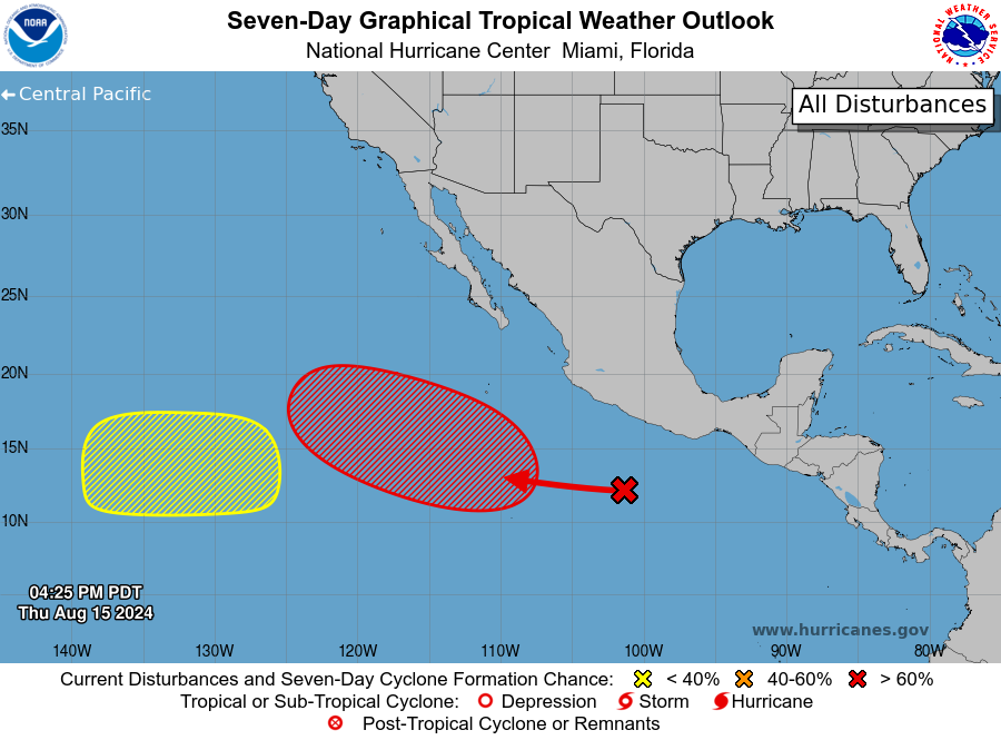
For the eastern North Pacific...east of 140 degrees west longitude:
1. Offshore of Southwestern Mexico:
Disorganized showers and thunderstorms located a few hundred miles
south of the southwestern coast of Mexico are associated with a
tropical wave. Environmental conditions appear conducive for gradual
development of this system during the next few days, and a tropical
depression is likely to form early next week while moving
west-northwestward away from the coast of Mexico.
* Formation chance through 48 hours...low...10 percent.
* Formation chance through 7 days...high...70 percent.
2. Western Portion of the East Pacific:
A broad area of low pressure could form by this weekend well to the
west-southwest of the southern tip of the Baja California peninsula.
Some slow development of this system is possible during the early
and middle parts of next week while it moves generally westward
across the western portion of the East Pacific basin.
* Formation chance through 48 hours...low...near 0 percent.
* Formation chance through 7 days...low...20 percent.
Forecaster Reinhart