ZCZC MIATWOEP ALL
TTAA00 KNHC DDHHMM
Tropical Weather Outlook
NWS National Hurricane Center Miami FL
1100 PM PDT Fri Oct 25 2024
For the eastern North Pacific...east of 140 degrees west longitude:
Active Systems:
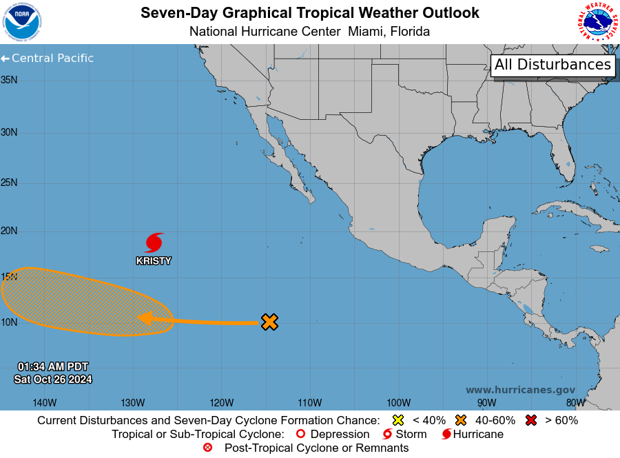
The National Hurricane Center is issuing advisories on Hurricane
Kristy, located over the western portion of the eastern Pacific
basin.
1. Western East Pacific:
A large area of showers and thunderstorms is currently located well
to the southwest of the southwestern coast of Mexico. An area of low
pressure could develop from this system over the next couple of days
as it moves into the western part of the East Pacific. Environmental
conditions are then forecast to be conducive for additional
development, and a tropical depression could form by the middle of
next week while the system moves westward or west-northwestward at
about 15 mph. This system is expected to move into the central
Pacific basin on Wednesday or Thursday.
* Formation chance through 48 hours...low...near 0 percent.
* Formation chance through 7 days...medium...40 percent.
Forecaster Papin