


NHC Graphical Outlook Archive
|
« Earliest Available ‹ Earlier Later › Latest Available » |
GIS Shapefiles |
| Central Pacific | Eastern Pacific | Atlantic |
|
Tropical Weather Outlook Text
ZCZC MIATWOEP ALL
TTAA00 KNHC DDHHMM
Tropical Weather Outlook
NWS National Hurricane Center Miami FL
1100 AM PDT Sat Nov 2 2024
For the eastern North Pacific...east of 140 degrees west longitude:
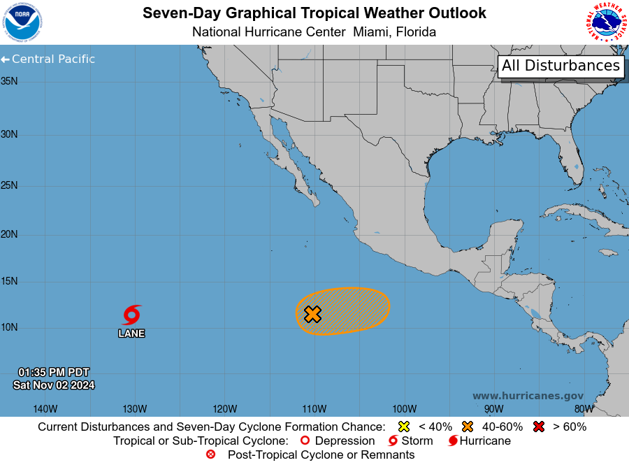
Active Systems:
The National Hurricane Center is issuing advisories on Tropical
Storm Lane, located over the western portion of the eastern Pacific
basin.
1. Southwest of Southwestern Mexico:
A broad area of low pressure offshore of the southwestern coast of
Mexico is producing disorganized showers and thunderstorms. Some
further development of this system is possible over the next few
days and a tropical depression could form during the early to middle
part of next week while the system drifts generally eastward to
east-northeastward.
* Formation chance through 48 hours...low...30 percent.
* Formation chance through 7 days...medium...40 percent.
Public Advisories on Tropical Storm Lane are issued under WMO header
WTPZ33 KNHC and under AWIPS header MIATCPEP3.
Forecast/Advisories on Tropical Storm Lane are issued under WMO
header WTPZ23 KNHC and under AWIPS header MIATCMEP3.
Forecaster Kelly
List of Atlantic Outlooks (May 2023 - Present)
List of East Pacific Outlooks (May 2023 - Present)
List of Central Pacific Outlooks (May 2023 - Present)
List of Atlantic Outlooks (July 2014 - April 2023)
List of East Pacific Outlooks (July 2014 - April 2023)
List of Central Pacific Outlooks (June 2019 - April 2023)
List of Atlantic Outlooks (June 2009 - June 2014)
List of East Pacific Outlooks (June 2009 - June 2014)