


NHC Graphical Outlook Archive
|
« Earliest Available ‹ Earlier Later › Latest Available » |
GIS Shapefiles |
| Eastern North Pacific | Atlantic |
|
Tropical Weather Outlook Text
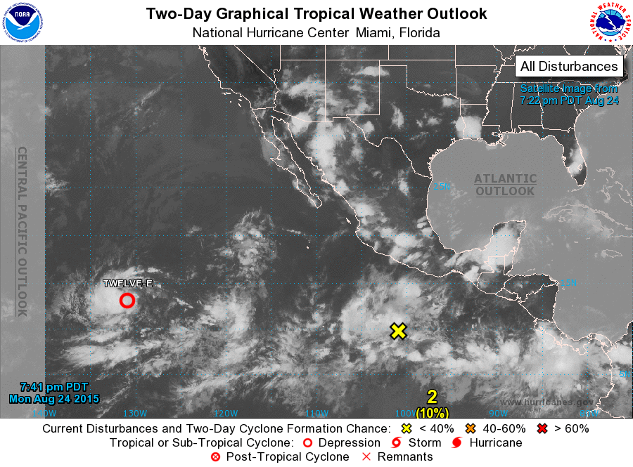
ZCZC MIATWOEP ALL
TTAA00 KNHC DDHHMM

TROPICAL WEATHER OUTLOOK
NWS NATIONAL HURRICANE CENTER MIAMI FL
500 PM PDT MON AUG 24 2015

For the eastern North Pacific...east of 140 degrees west longitude:

1. Satellite imagery and satellite-derived surface winds indicate that
the low pressure system located about 1500 miles west-southwest of
the southern tip of the Baja California peninsula has continued to
become better organized.  Environmental conditions are conducive
for additional development and only a slight increase in
organization would result in the formation of a tropical depression
tonight or Tuesday.  The low is expected to move slowly
westward and then west-northwestward during the next few days.
* Formation chance through 48 hours...high...90 percent
* Formation chance through 5 days...high...90 percent

2. Shower and thunderstorm activity continues in association with
a tropical wave located several hundred miles south of the coast of
southwestern Mexico.  Environmental conditions are forecast to be
conducive for gradual development of this disturbance, and a
tropical depression is likely to form late this week while the
system moves west-northwestward at 10 to 15 mph.
* Formation chance through 48 hours...low...10 percent
* Formation chance through 5 days...high...80 percent

Forecaster Roberts
List of Atlantic Outlooks (May 2023 - present)
List of East Pacific Outlooks (May 2023 - present)
List of Central Pacific Outlooks (May 2023 - present)
List of Atlantic Outlooks (July 2014 - April 2023)
List of East Pacific Outlooks (July 2014 - April 2023)
List of Central Pacific Outlooks (June 2019 - April 2023)
List of Atlantic Outlooks (June 2009 - June 2014)
List of East Pacific Outlooks (June 2009 - June 2014)