Proposed changes to NHC tropical cyclone forecast graphics for 2017
Overview
The National Hurricane Center is proposing changes to the appearance of the graphics accompanying tropical cyclone advisory packages for the 2017 hurricane season. These changes would be required for the NHC and CPHC to begin issuing forecasts and watches/warnings for potential tropical cyclones as proposed in Public Information Statement 17-XX – Soliciting comments for 30 days on changing criteria for issuing tropical cyclone watches and warnings to include certain land-threatening disturbances that are not yet tropical cyclones. In addition, three new kml files are proposed and the wind speed probability GIS files would be available at higher resolution.
A summary of these proposed changes is available in NWS Public Information Statment 17-10
Examples and urls
New static versions of the regular graphics, and some new graphics are proposed to be available in 2017. Examples of all products are listed in the table below. Clicking on the thumbnail images in the table will bring you to a full-resolution example of the graphic.
Please note that "www.hurricanes.gov/storm_graphics/BBNN/" preceeds all of the static graphic urls, where BBNN is the storm basin and number (examples: AT09, EP02, AT11). A complete key is available below the table.
| Graphical Product | Example of old Graphic | Example of new (2017) Graphic | Old Static url* | New (2017) static url* |
|---|---|---|---|---|
| 5-day Tropical Cyclone Track Forecast Cone and Watches/Warnings | 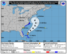 |
BBNNYYW5_NL.GIF | BBNNYYYY_5day_cone_no_line.png | |
| 5-day Tropical Cyclone Track Forecast Cone, Initial Wind Field, and Watches/Warnings | (n/a - wind field added to forecast cone and W/W graphic) | 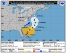 |
(n/a) | BBNNYYYY_5day_cone_no_line_and_wind.png |
| 3-day Tropical Cyclone Track Forecast Cone and Watches/Warnings | 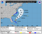 |
BBNNYYW_NL.GIF | BBNNYYYY_3day_cone_no_line.png | |
| 3-day Tropical Cyclone Track Forecast Cone, Initial Wind Field, and Watches/Warnings | (n/a - wind field added to forecast cone and W/W graphic) | 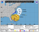 |
(n/a) | BBNNYYYY_3day_cone_no_line_and_wind.png |
| Tropical Cyclone Surface Wind Field | 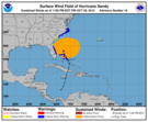 |
BBNNYYR.GIF | BBNNYYYY_current_wind.png | |
| Tropical Cyclone Cumulative Wind History |  |
BBNNYYS.GIF | BBNNYYYY_wind_history.png | |
| Tropical Cyclone Surface Wind Speed Probabilities | 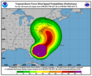 |
BBNNYY_PROB34_Fff.GIF BBNNYY_PROB50_Fff.GIF BBNNYY_PROB64_Fff.GIF |
BBNNYYYY_wind_probs_34_Ffff.png BBNNYYYY_wind_probs_50_Ffff.png BBNNYYYY_wind_probs_64_Ffff.png |
* Table Key
- All urls are preceeded by "www.hurricanes.gov/storm_graphics/BBNN/"
- BB: 2-digit basin id (capital letters, AT or EP)
- NN: 2-digit storm number (examples: 01, 09, 21)
- YY: 2-digit year (examples: 15, 16, 17)
- YYYY: 4-digit year (examples: 2015, 2016, 2017)
- ff: 2 or 3-digit forecast hour (examples: 00, 12, 24, 108, 120)
- fff: 3-digit forecast hour (examples: 000, 012, 024, 108, 120)
Comments
Send comments or requests for more information to:
Jessica Schauer
NWS Marine, Tropical and Tsunami Services Branch
National Hurricane Center
Miami, FL 33165
Telephone: 305-229-4476
Email: Jessica.Schauer@noaa.gov
or
Wayne Presnell
NWS Marine, Tropical and Tsunami Services Branch
Silver Spring, MD 20910
Telephone: 301-427-9390
Email: Wayne.Presnell@noaa.gov


